This article was written by Mr & Mrs Filsell for the 2013 Metro-land exhibition and is reproduced with permission
As soon as the station at Amersham was built building started just below it with a handful of both shops and houses. Construction further from this area began not long after and was fairly steady in the next twenty years, but it was not until the sinking of a new well, the building of a new reservoir and, finally, a water tower at Coleshill, that there was sufficient water pressure to provide an adequate water supply for large-scale building to go ahead.
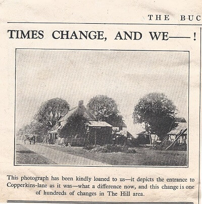
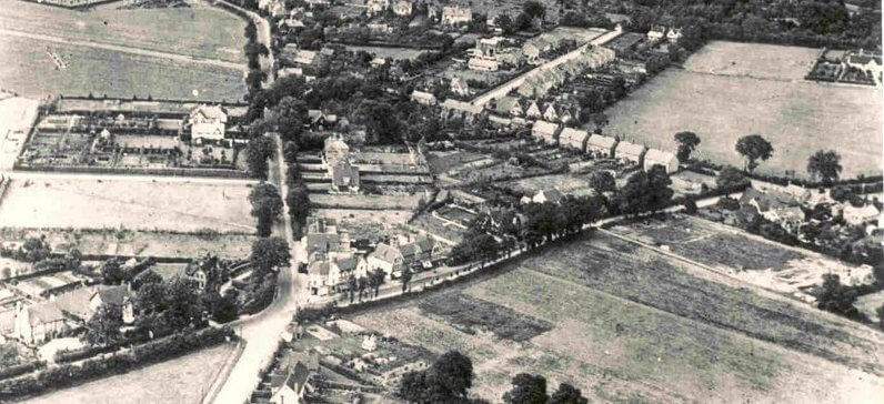
The main expansion took place in the area from Oakfield corner up to the boundary with Chesham Bois – up Chesham Road to what is now South Road and what was then all Amersham Common, down to Bois Lane and extension of the relatively new Sycamore Road. (Click here to see a 1920 aerial photo.) Ironically this area could have been very different as, in 1871, the directors of the Metropolitan railway proposed a line to Aylesbury to go across Chesham Bois Common and Chesham Road and continue across Copperkins Lane. The line, if built, would have run about 100 feet north of the present day South Road. This plan achieved its aim of persuading Tyrwhitt-Drake to end his opposition to the line from Harrow to Aylesbury, as it would no longer be seen from Shardeloes. However the Metropolitan ran into financial difficulties, and, though given Parliamentary approval in 1871, it was never built.
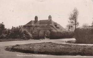
One of the very first new houses in this area was on the boundary of Chesham Bois, on the corner of Chestnut Lane, though the address is now Sycamore Road. This was the Dial House which was there in 1911 and contains some Arts and Craft features to this day. By December 1911 there were enough residents to propose the creation of a bowls club. This was opened the following June in a club positioned off the footpath between Sycamore Road and Parkfield Road, behind the garden of the Dial House. It was opened by one of the first doctors in the area Dr Humphrey England. A year later the club was sufficiently popular to be well in funds and hold an anniversary dinner.
DOCUMENTS
The documents shown below concern the sale of land on Amersham Common and glebe land owned by St Mary’s Church.
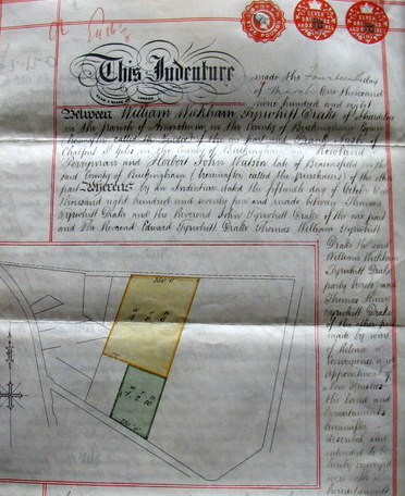
This document concerns land owned by Bent’s Charity which was set up by a widow, Mrs Elizabeth Bent, in 1728 and was run by a trust usually headed by a Tyrwhitt-Drake. The money gathered from the rent of this land was used to fund the charity. In 1907 it was decided that, for administrative purposes, the money obtained by the sale of the land should be invested in stocks, funds and securities authorised for trust funds. The land consisted of 2 plots, coloured red and green on the document, totalling just over 5 acres, stretching from Chesham Bois Common to what is now Rickmansworth Road. This amounted to five and a half acres, and would include the future Lexham Gardens running roughly through the middle of it In January 1908 the two plots were sold £809/8/6 and £306/10 respectively to R Perryman and J Watson, who sold the land on for building in 1910.

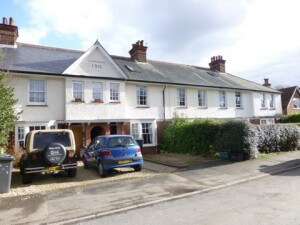
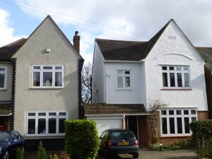
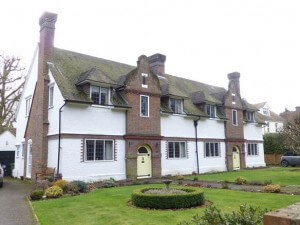
This document shows the indenture made by the Rev Charles Briggs, Rector of St Mary’s and others of land of just under half an acre below the Boot and Slipper down to what is now Lexham Gardens. It would appear from the first document that this new road was going to be named Bent’s Road, but, for unknown reasons was eventually called Lexham Gardens, by which name it was being referred to in 1912. The photo below on the right shows the 8 houses in Lexham Gardens constructed in 1911 and the one below on the left the earliest, built in 1909.
NEW ROADS AND HOUSES TO NORTH AND EAST
From the time of the sale of the 2 plots, building of houses began. The earliest were in South Road where Rahere and St Stephens Cottage, now numbers 13 and 14, designed by the architect John Kennard were built as early as 1907 and shown below. Not long after, in 1909, what are now numbers 5 and 7 in Lexham Gardens were built, to be followed 2 years later by a block of 8 houses from 23 to 27.
From now on only a handful of new houses went up, which included some architecturally unusual ones in Rickmansworth Road. These were Sakkarah, Glenn Cottage, Shaldon and Rozel, two of which look like Dutch houses. All of these 4 are still there, though only two with the same name. The other side of Rickmansworth Road was originally lined with houses, including two shops, but many of these were demolished in the 60’s to make room for the car park. South Road saw the construction of one of the larger houses – Greenbank- in 1911, with the smaller Greenbank Cottage linked to it. A further four houses nearer to Chesham Road were also built in the same year in the same year.
It was only after the completion of the improved water supply works and, most importantly, the end of the first World War in November 1918 that building plans began to flood in. There had been some during the war years, but these were mainly to do with drainage, but from 1920 a large number of plans were submitted and building of houses in the area took off. By the end of the 1920s just about all of the South Road houses had been completed, at least one of which, and probably more, was designed by Kennard, and, though some have been much altered, most remain today. The photo to the right shows number 16 designed by Kennard in 1920. Number 22 had a frontage so far back that, fairly recently, a new house was put up there and the old one had its frontage in Sycamore Close. In the 1970s the builder Alfred Woodley’s house, called Longwood, standing at the Sycamore Road end of South Road, was pulled down and replaced by 3 houses.
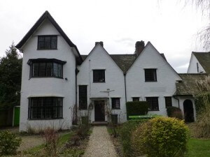
A few of the original houses still retain their names on view, like St Stephen’s Cottage and Greenbank House (shown here) but, generally speaking, the names have been changed or dispensed with. All the original houses had only names and the few from before 1907 on Amersham Common, only had the names of the occupants. Lexham Gardens was given numbers in the 30’s but South Road did not have them until the early 50’s, when some occupiers were horrified as they considered it rather infra dig!
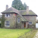
SOME OWNERS AND OCCUPANTS
Unlike today when virtually all the houses in this area are used as homes, in the early days there was a scattering of businesses amongst dwelling houses. There was a coal merchant – Jesse Parsons and sons – in the middle of the east side of Lexham Gardens (number 15) and a builder’s yard at the very beginning of the road where the dentist now practises. Opposite the coal merchant was the Alfred Woodley’s builders yard with, later, a shop on the road. This was not pulled down until the end of the 1980s and the convenience of the shop is still remembered. When the yard was first built, the great grandson of Madame Tussaud set up a work shop there and made his own wax works and, in the 20’s staged an exhibition in Regent Street in London but this failed so he set up another one in Brighton. This later moved to Butlins when the workshop provided staging for it.
Number 5 Lexham Gardens was renamed Peacehaven in the 1930s and became a nursing home into the second world war years complete with Matron, although how it could have housed more than a very small number of patients is difficult to imagine. In the 1990s, when Dorothy Hall, the music teacher at number 4 moved, the land was sold for new houses, and these, together with the new Springfields and houses on Lexham Gardens, has changed the west side of the road but the east remains very much as it was originally.
In South Road the houses have mainly been solely homes from the start, except for Longlow House, number 1, which was first houses, then a girls’ school, houses again and then a club until Guido’s Restaurant opened in the 70’s.
SOURCES
- Amersham on the Hill a Railway Town S Eveleigh 1976
- Wikipedia (Coleshill water tower)
- The Book of Amersham L Elgar Pike and C Birch 1976
- Yesterday’s Town Amersham N Salmon and C Birch 1991
- A History of Amersham J Hunt 2001
- Amersham street directories
- Kelly’s Directories from 1903
- Bucks Herald 1911
- Bucks Examiner 1912
- Surveyors’ Report Book DE9/22/21/1 Centre for Buckinghamshire Studies
- Valuation List DC9/5/21 ibid

