by Nick Gammage, January 2024
Alison Bailey’s article about intriguing local place names recounts a popular explanation for the origin of the curiously named Copperkins Lane: that it took its name from the copper skins of travellers who camped each year along its verges on the margins of the Common. “Copper skins” is a plausible solution – Copperkins Lane once formed part of an ancient drovers’ road running from Wales through the Chilterns and across Amersham Common to the London livestock markets.
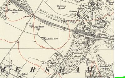
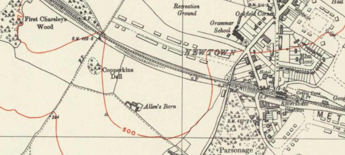
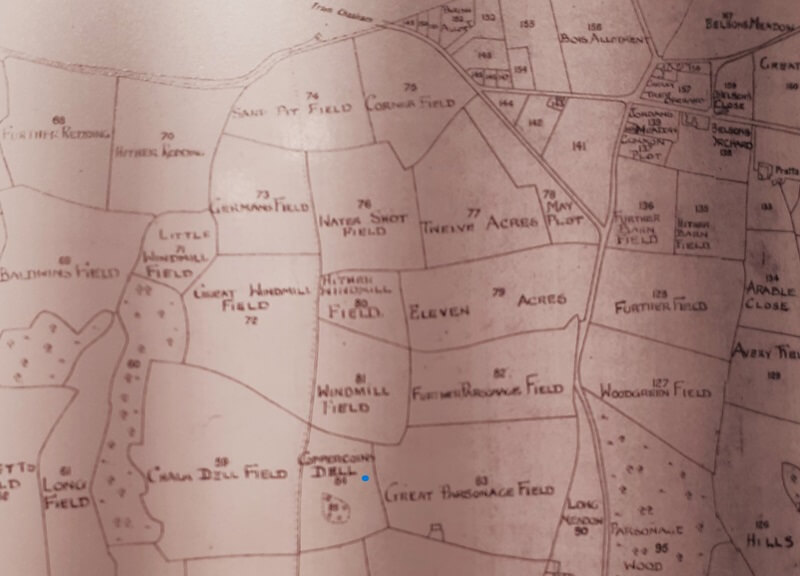
Alison also points to another “Copperkins” in this area: a small grassy hollow covered by trees to one side of the extensive steeply sloping field to the west of Amersham Rectory (Grid Ref. SU 956982) described on 19th Century O.S Maps of the area as “Copperkins Dell”. Earlier maps show this local woodland marked as Coppercoins Dell, suggesting a long forgotten archaeological find, and another possible origin for the name.
However, a group of newly-discovered old deeds relating to a little-known family living in Medieval Amersham – the Coperkyngs – and the 19th century notebooks of an Ordnance Survey surveyor seem to provide compelling evidence for an alternative explanation.
At a time when spelling was haphazard at best the Coperkyng family name is found recorded in a number of variants: Coperkyng, Coperking, Kupping, Cuppyng. The earliest recorded mention I have discovered comes in a charter of around 1275 held in the Cartulary of Missenden Abbey which relates to a
“Grant by Henry de Sythre to Reginald Coperkyng of an annual rent of twelve pence arising out of the tenement of Alice de Sythre in the parish of Great Missenden. For this concession Reginald has given him ten shillings”
In simple terms, Reginald Coperkyng (“Reginaldo Coperkyng” in the legal Latin of that charter) is renting out a home in Great Missenden parish to Alice de Sythre. Two other documents from that period, now in the National Archives, locate the Coperkyngs even closer to Amersham and Chesham Bois.
The first, a deed of 1340 recorded in The Catalogue of Ancient Deeds Held in the Public Record Office (HMSO, 1894) relates to a “Martyn Coperkyng of Chesham.” It renders null and void a bond between Martyn and his son “William Coperking”:
“C. 2286. Defeasance of a bond by Martyn Coperkyng, of Chesham, and William Coperking his son, by which they are bound to each other, the said Martyn in 100s. and the said William in 10 marks, the said bond being in the hands of John de le Sekersteyn, of Agmodesham; witnessing that if the said Martyn shall not demise, for term of his life, any of his lands in the parish of Chesham except a plot called ‘Collinggeswyk’ without William’s consent, and if the said William shall not withdraw himself from the service and support of his parents, the said bond shall be void. Sunday after Michaelmas, 13 Edward III. French”
The “Collinggeswyk” referred to here is an ancient Chesham field name – meaning “Colin’s farm”.
The second deed, from 1311, brings the Coperkyng family into Chesham Bois and even closer to the line of Copperkins Lane. It records the outcome of an inquiry following the death of William de Brianzon to establish the extent of his lands (known as an “Inquisition Post Mortem”). Held on “Saturday, the morrow of the Circumcision” (i.e. January 2nd, 1311), it established that William’s lands included a significant holding of 48 acres in Chesham Bois which he had been leasing from one Robert Coperkyng:
“Boys in Cesteresham (i.e. Chesham Bois). The hamlet, held of John de Goys by service of 1/2 knight’s fees; 4a. meadow and a watercourse for his mill, held of Robert de Veer, earl of Oxford, by service of 6s. 8d. yearly; 6a. land held of Humphrey de Boun, earl of Hert(ford) (sic), by service of 21d. yearly; 24a. land held of the manor of La Grave, which is in the king’s hand, by service of 8s. 8d. yearly; and 42a. land held of Robert Coperkyng by service of 12d. yearly.”
This is unlikely to have been the Coperkyng family’s only land holding in the area. They were clearly influential, appearing as witnesses on deeds relating to other powerful local families such as Thomas of Agmodesham of Quarrendon Farm, and Adam and Walter Wace.
It is easy to imagine how in 14th century Amersham that ancient track might have been related to a nearby landowner and spoken of as Coperkyng’s Lane and the hollow known as Coperkyng’s Dell. It is easy to imagine too how that name might be heard as “Copkin’s” or “Copperkin’s”, and how over time it came to be written down as Copperkins Lane and Copperkins Dell.
This theory appears to be confirmed by the remarkable notebooks and sketch maps of Lieutenant Colonel Arthur Blayney Coddington R.E. of the Ordnance Survey who in 1869 surveyed the area on foot to establish parish boundaries.
Coddington’s notebooks now in the National Archives show he walked the boundaries with the local “meresmen” George Priest of Amersham, Henry Glenister of Chesham Bois, and Edwin Birch of Hundridge sketching as he went – “meresman” being an archaic word used to describe someone empowered to agree local boundaries.
On one sketch Coddington draws Copperkins Lane as “Copkins Lane”. But on the next page ‘Copkins’ is crossed out by hand and replaced by ‘Copperkins’. George Priest and Edwin Branch have signed the page to show that they approve the change. They may indeed have suggested it.
In the revised printed version of his sketch map, printed in 1874, Coddington makes the same change. The printed “Copkins Lane” – how it had previously been written – is crossed out by hand and replaced in red ink by “Copperkins Lane”.
The surname Coperkyng is itself of obscure origin. Ernest Weekley’s great reference work Surnames (1916) records Coperkyng as an “obsolete compound surname” made up of two elements, “Coper” and “Kyng” or “King”. That ‘Coper’ is problematic: there is no evidence of Copper deposits or smelting in the Chilterns. ‘Coper’ may have its root in a Middle French verb meaning to strike, but that is far from certain. It is sometimes found written on the Continent as Kupping. And what about that “king”?
While those Medieval deeds might help explain the origin of Copperkins Lane and Dell they at the same time create their own mystery: who were the Coperkyng family? and what became of them? They do not appear in any of the histories of this area and there appear to be no references to them later than the 14th century.
Did the male Coperkyng line simply die out? Do any Coperkyng descendants remain in the Amersham/Chesham Bois area or elsewhere? If so, it would be fascinating to hear from them.